Created 13-Jun-21
21 photos
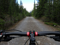
Megan and I went for a mountain bike ride today - a rather long one. Elbow Loop (which combines Little Elbow and Big Elbow Trail) is a 42 km long route that is comprised of rolling terrain, mostly along a fire road. Some parts are cobbly, some smoother.
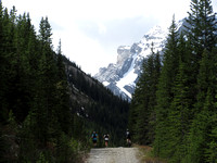
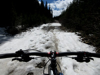
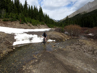
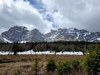
We biked the loop counterclockwise, first heading west up Little Elbow Trail. After a snack break at Mt. Romulus Backcountry Campground, we headed south toward Tombstone Pass. Much elevation gain along this section meant we had to push our bikes along steeper parts, and eventually we came across snow patches on the trail. The elevation here at the high point is 2250 m, so the snow is slow to melt off here in the spring. The scenery was really quite good all along the trip with constant views of the surrounding peaks, but Tombstone Pass stole the show.
What followed was a blissful 2 km fast descent down to Tombstone Backcountry Campground. Here, we had a second break and assessed the map - 22 km down and 20 km to go.
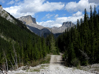
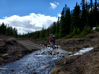
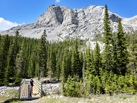
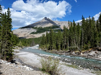
The next stretch ran eastward along the Big Elbow Trail. This section was predominantly rolling singletrack. We crossed Outlaw Creek and then came to two large, new bridges that had been installed in the post-2013 flood re-build. Big Elbow Backcountry Campground followed soon thereafter. It is a very picturesque site along the bank of the Elbow River under Threepoint Mountain.
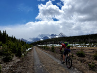
The last stretch of trail travelled northward. It was fine-grained, hard-packed doubletrack that was slightly downhill the whole way, making for a fast rip back to the trailhead.
I'm really proud of Megan for completing this loop - it's quite an undertaking for a beginner!
Category:
Subcategory:
Subcategory Detail:
Keywords: